

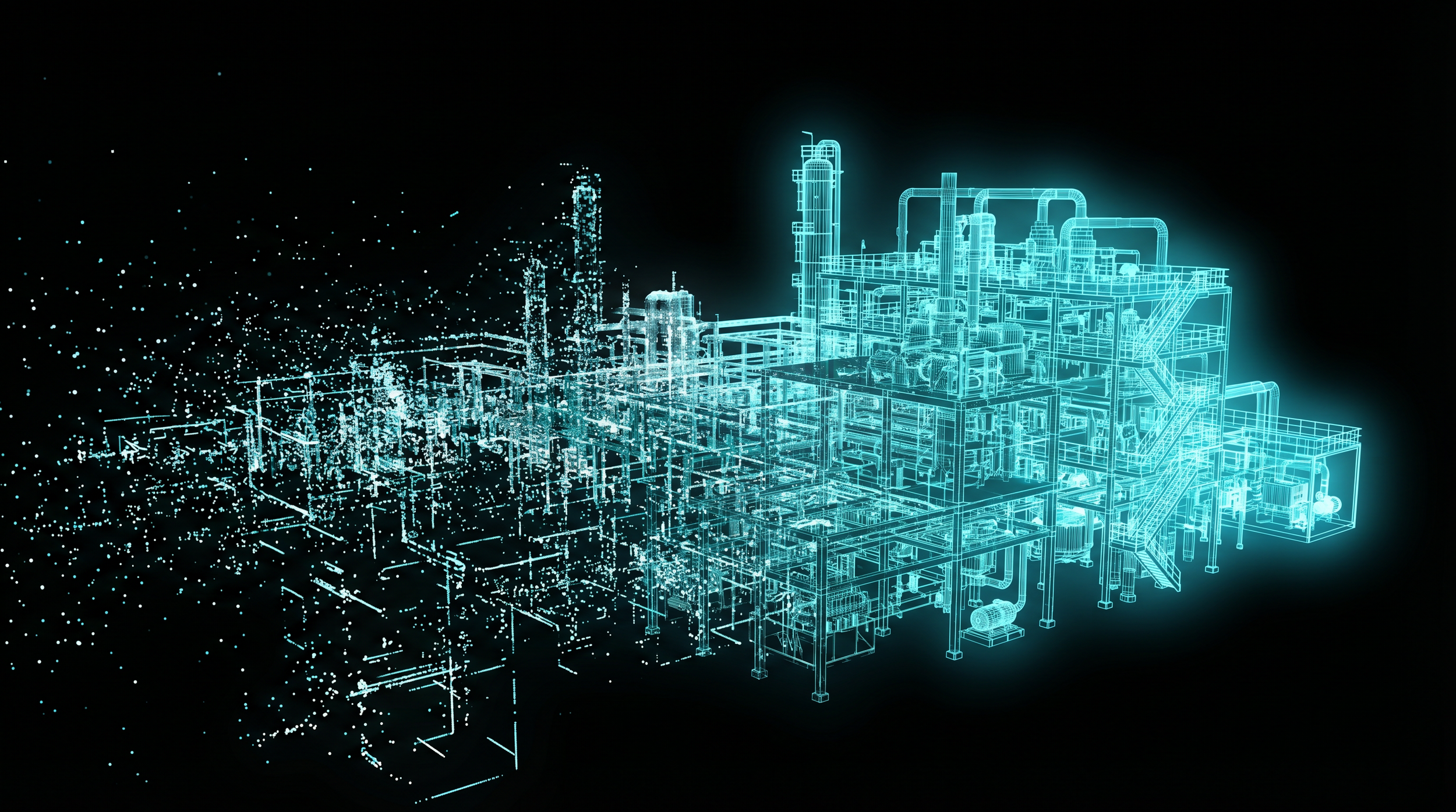
Digital Twins & 3D to 8D Modelling
Unified Digital Twins: From Subsea to Summit
Engineering-grade 3D models that integrate every asset, every layer, aerial, confined space, interior and underwater data, all unified in one model, on a single platform.
Accessible from any browser, on any device, by your entire team. Unify your asset data.
20-50% lower total lifecycle cost vs traditional inspection and documentation methods.
ISO 9001 |
ISO 45001 |
ISO 14001 |
CASA ReOC |
$20M Insured |
Bridge Inspection L1 |
ISO 9001 | ISO 45001 | ISO 14001 | CASA ReOC | $20M Insured | Bridge Inspection L1 |
The Cost of Fragmented Asset Data
Reactive Maintenance costs 3-5x more
Without trend data and predictive capability, maintenance remains reactive. Reactive maintenance costs 3-5x more than planned maintenance and causes unplanned downtime, safety incidents, and budget blowouts.Increased Operational Impact
Critical defects are missed by visual inspections and fragmented, inconsistent data, driving reactive maintenance, higher costs, greater risk, and increaseing downtime.A Digital Twin Is Not a 3D Model
Scattered Records, Slow Decisions
Aerial contractor delivers orthophotos. Dive team delivers a video report. Rope access team delivers a spreadsheet. Fragmented data obscures true asset priorities; inconsistent comparisons increase costs, risks, and operational impact. By the time it reaches the decision-maker, the data is already weeks or months old. | Feature | Standard 3D Model | DeepSky IQ Digital Twin |
|---|---|---|
| Accuracy | ✕Variable, often unverified | ✓Survey-grade, ±2cm absolute position |
| Updatable | ✕Static snapshot | ✓Living model, updated each inspection cycle |
| Measurable | ✕View only | ✓Measure distances, areas, volumes directly |
| Change Detection | ✕Manual comparison (if possible) | ✓Automated time-series overlay |
| Multi-Source | ✕Single capture method | ✓Aerial + ground + confined space + subsea |
| Collaboration | ✕File-based sharing (large downloads) | ✓Browser-based, no software install required |
| Integration | ✕Format-dependent, often incompatible | ✓Open standards (OGC 3D Tiles, LAS, IFC, GeoTIFF) |
| AI Analysis | ✕Not available | ✓Automated defect detection with severity classification |
A 3D model shows you what an asset looks like. A digital twin tells you what is happening to it, what has changed, and what will fail next.
| Dimension | Name | What It Adds |
|---|---|---|
| 2D | Plans & Drawings | Traditional flat documentation |
| 3D | Interactive Model | Measurable spatial representation of the physical asset |
| 4D | + Time (Schedule) | Construction sequencing, inspection timelines, progress tracking |
| 5D | + Cost (Budget) | Cost per defect, maintenance budgeting, lifecycle costing |
| 6D | + Facilities Management | Maintenance scheduling, work order integration, asset registers |
| 7D | + Sustainability (Lifecycle) | Degradation modelling, remaining useful life, replacement planning |
| 8D | + Safety & Compliance | WHS compliance tracking, hazard registers, incident spatial mapping |
From 2D Plans to 8D Intelligence
We deliver the intelligence layers that transform a model into a decision-making platform.
Powered by an enterprise reality modelling platform. Delivered via browser-based 3D viewer.
Enterprise reality modelling platform
The infrastructure industry's leading reality modelling platform. Processes photographs, LiDAR point clouds, and mixed-sensor datasets into engineering-ready digital assets: reality meshes, Gaussian splats, point clouds, orthophotos, and digital elevation models. Parallel processing engines handle city-scale projects. Custom AI models classify defects automatically.Browser-based 3D viewer 3D Tiles
Your completed digital twin is streamed to any web browser via OGC 3D Tiles, the open geospatial standard. No software installation. No vendor lock-in. Share with unlimited team members. Measure, compare, and track change over time from a single web link.Edge AI (Onboard Processing)
Real-time defect detection during capture, not days later in post-processing. 100 TOPS of onboard GPU processing identifies anomalies, classifies severity, and alerts operators before the drone lands. Your data arrives pre-screened.Digital Twin Business Case Calculator
Quantify the total value of transitioning from static documentation to living, measurable digital twins across your portfolio.
Request Your Full Business Case
We'll prepare a detailed digital twin program assessment based on your inputs above, including scope, timeline, and full ROI analysis.
| Deliverable | Format | How You Access It |
|---|---|---|
| Interactive 3D Digital Twin | OGC 3D Tiles | Web browser, any device, unlimited users |
| Reality Meshes | OBJ 3D Tiles | Download or stream |
| Gaussian Splats | Photorealistic | Web viewer (cinematic quality) |
| Point Clouds | LAS/LAZ | Download, GIS import (ASPRS standard) |
| Orthophotos | GeoTIFF | GIS, CAD overlay |
| Digital Elevation Models | DEM/DSM/DTM | Engineering analysis, flood modelling |
| BIM Comparison Overlay | IFC | Design vs as-built deviation analysis |
| Cinematic Walkthroughs | Video Interactive | Client presentations, stakeholder engagement |
| Change Detection Reports | Time-series | Condition tracking, degradation trends |
| Defect Register | CSV GIS-linked | Classified, severity-graded, spatially located |
| Thermal Overlay | Radiometric 3D | Moisture, energy loss, electrical anomaly mapping |
Estimate Your Savings
A Single Source of Truth
Four Environments. One Unified Digital Twin.
Engineering-grade data your team can act on today.
One procurement, four environments
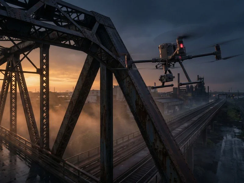
Stop managing multiple contractors. We cover air, ground, internal, confined space, and underwater data capture in a single program.Digital twins accurate to 2cm
Measure, categorise, prioritise, plan, schedule, assign, track and monitor remotely. Design vs build transparency, Progress AI tracking, Safety AI compliance improvements. No return site visits.Beyond 3D models that predict the future
Go beyond 3D to track asset degradation over time, embed 2D outputs for design vs. build, manage costs, enable predictive maintenance that prevents failures, manage your asset lifecycle, and improve health and safety outcomes and compliance reporting. 8D models that predict costs, keeping you on budget
Clear value for every defect, track asset costs, on-time rectifications, and degradation over time, enabling reprioritisation, trades scheduling and tracking, and QA of completed works.Seamless BIM/CAD & GIS integration
Seamless BIM and GIS integration. Your digital twin integrates with your existing software including Procure, Autodesk Revit, and Esri ArcGIS, with additional platform compatibility available on request.AI-powered detection
Automatically identify, classify, and measure anomalies with up to 98.5% accuracy with millimetre levels of detection, from crack mapping, delamination, to cut & fill and volumetrics.30-40%
Rework Reduction
+/- 2cm
Absolute Positional Accuracy
Sub Cm
Levels of Detail
>40%
Cost Reduction
One
Single Source of Truth
Digital Twins Across Every Sector
Bridge, tunnel, and road network condition models with change detection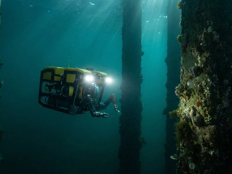
Wharf structure models combining aerial + underwater ROV data in one twin.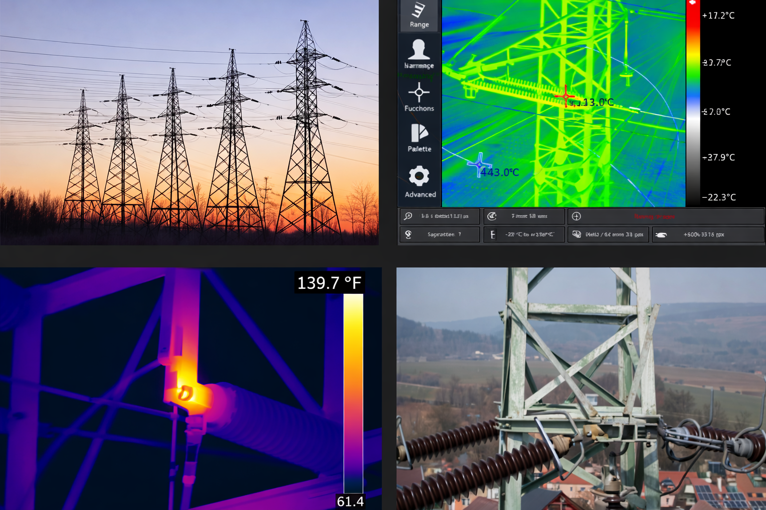
Transmission line corridors, substation 3D models, dam digital twins, solar farm condition.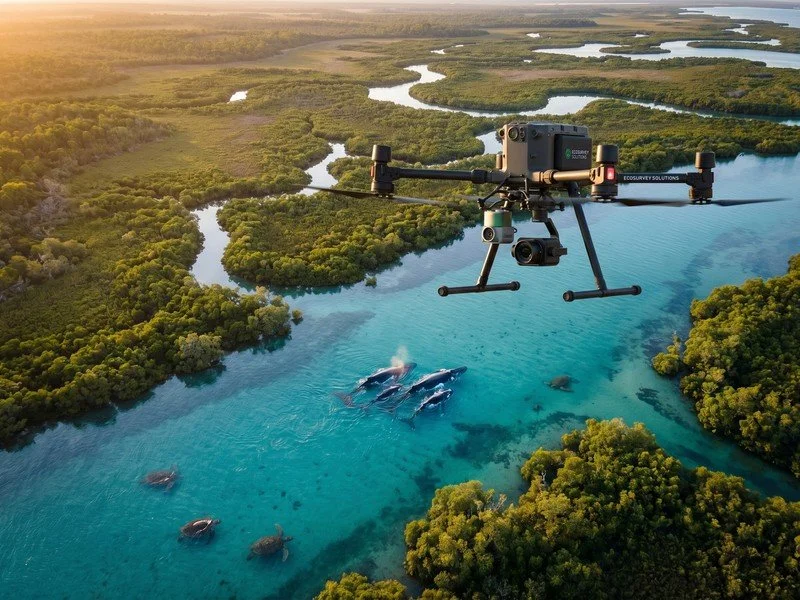
Centimetre-accurate terrain and vegetation models for compliance reporting, offset verification, and change detection & Managment.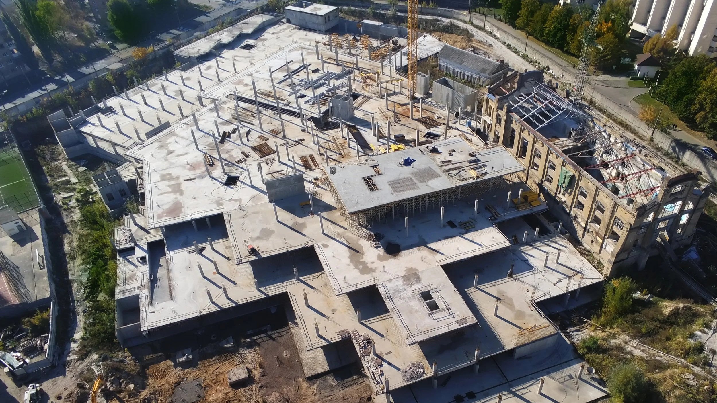
Engineering, Construction & Development
Design vs as-built verification, progress tracking, defect registers. 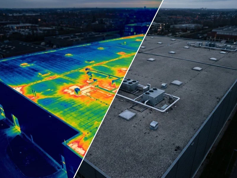
Property & Facilities Management
Building condition models, facade inspection, maintenance planning.
One auditable, accessible record of every public asset, enabling data-driven prioritisation across your entire portfolio.
Timestamped, survey-grade spatial evidence that replaces subjective site reports in disputes and claims.Develop Your Digital Twin Program
From a single building to a multi-asset portfolio. We capture the data, process it through enterprise reality modelling platform, and deliver an interactive digital twin your entire team can access from any browser. Move from fragmented records to a unified, intelligent view of your asset portfolio.Frequently Asked Questions
What is a unified digital twin?
A unified digital twin is a single, measurable 3D model that combines asset data from aerial, ground, confined space, interior, and underwater sources into one complete representation. Unlike separate models for each environment, a unified twin provides a seamless spatial record from the tops of towers to 500 metres underwater, all georeferenced to real-world coordinates and accessible from a single browser link.
What is the difference between a digital twin and a 3D model?
A 3D model is a static geometric representation at a single point in time. A digital twin is a living, data-connected replica that evolves with the physical asset. It matches real-world size and position, tracks changes over time, links to IoT sensors for live monitoring, and supports engineering measurement directly from the model. We deliver from 3D through to 8D intelligence: 3D (measurable geometry), 4D (change over time), 5D (cost and remediation planning), 6D (condition lifecycle and remaining useful life), 7D (compliance and regulatory mapping), and 8D (live operational integration with IoT and sensor feeds).
What processing platform do you use?
All data is processed through the infrastructure industry's leading enterprise reality modelling platform. It handles photogrammetry, LiDAR point clouds, and mixed-sensor datasets at any scale. AI-powered defect detection automatically classifies cracks, corrosion, spalling, and coating degradation. Automated change detection compares surveys over time. Completed digital twins are streamed to any web browser via OGC 3D Tiles. No software installation. No vendor lock-in. Share with unlimited team members via role-based access.
How much does a digital twin cost in Australia?
Digital twin costs depend on site area, level of detail, number of environments (aerial, confined space, 360 interior, concealed spaces, underwater), and whether ongoing updates are needed. Digital twin programs typically deliver 40-70% cost savings compared to traditional survey and inspection methods for equivalent asset coverage. Multi-asset programs achieve further reductions through structured pricing and automated processing pipelines. Every engagement starts with a free scoping call and fixed-price quote.
What level of accuracy can we expect?
RTK-enabled aerial capture delivers positional accuracy of +/-2cm with Ground Control Points. LiDAR point cloud accuracy is 3cm vertical and 4cm horizontal from our enterprise aerial platform. Confined space and interior capture achieves millimetre-level detail for engineering measurement, crack width analysis, and volumetric calculation. We scope the detail requirements during project planning so you receive exactly what you need.
How do you integrate with our existing software?
Our digital twins integrate with common enterprise platforms including Autodesk Revit, ESRI ArcGIS, SAP, Maximo, Trimble, and most GIS and BIM systems. Data exports in open formats (LAS/LAZ, OBJ, IFC, GeoTIFF, CSV, GeoJSON, DXF) for direct import into any system that accepts industry-standard spatial data. Our open-format approach means no proprietary lock-in.
Can you model assets you cannot see, like concealed works and underground utilities?
Yes. We integrate photos from contractors, AR overlays accessible from your mobile phone, and underground utility data all into the unified 3D model. In GPS-blocked confined spaces, our drones and robots capture millimetre-level detail to build highly accurate 3D digital twins from the inside out. Ground-penetrating radar data, as-built drawings, and contractor photography are all georeferenced and layered into the model for a complete picture of visible and concealed infrastructure.
Can a digital twin integrate with IoT sensors for real-time monitoring?
Yes. Our digital twins connect to IoT sensor networks for real-time condition monitoring including structural movement sensors, temperature and humidity monitors, water level gauges, vibration sensors, and corrosion rate monitors. Sensor data is visualised directly within the 3D model, allowing your team to see exactly where anomalies are occurring in spatial context. Automated alerts trigger when thresholds are exceeded. This transforms your digital twin from a static record into a predictive maintenance platform (8D intelligence).
How long does it take to create a digital twin?
Single-asset (building, bridge, facility): 1-2 days capture, 5-10 business days processing. Complex multi-environment projects: 3-5 days capture, 2-4 weeks processing. Interim deliverables (raw imagery, preliminary point clouds) within 48 hours for time-critical projects. For ongoing programs with scheduled capture cycles, automated processing pipelines reduce turnaround to 3-5 business days per cycle.
What is the ROI of a digital twin?
Industry research shows 5-12% rework reduction, 10-15% schedule improvement, and 35% reduction in maintenance costs for organisations using digital twins. Our clients typically see 3-5x return within 2 years through eliminated site revisits, reduced rework, predictive maintenance, and avoided unplanned failures. The value compounds with each survey cycle as change detection and lifecycle predictions become more accurate over time.
How is browser-based delivery different from traditional file handover?
Traditional delivery means large files (often 10-50GB+) that require specialist software, powerful hardware, and trained operators to open. Our browser-based delivery streams your digital twin to any device via a shareable web link. No downloads. No software installation. No IT department involvement. Your engineers measure directly in the model. Your executives view narrated 3D flythroughs. Role-based permissions control who sees what. The model loads instantly regardless of dataset size because it streams progressively using optimised 3D tiling technology.